2026 Leadership Summit

GIS/GPS MAPPING
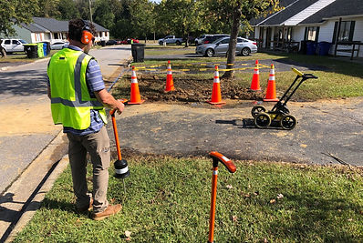
Need to map your system, but don't know how? North Carolina Rural Water Association can help. We’ll show you how to use a Geographic Information System (GIS) and a Global Positioning System (GPS) to locate all your assets so you can better manage them. If you don’t have the necessary equipment, that's okay. We have everything you need to get started, so you don’t have to make a large investment in the GIS/GPS software. For example, you can collect information about water lines, such as line size, material, installation date, and the contractor's name. Similar information can be collected for meters, valves, hydrants, pressure reducers, etc. All this information is then stored in a database system and is used to produce an accurate snapshot of your system. Utility managers can use this information to make informed decisions for operational and financial planning. GIS/GPS is a powerful tool. To learn more about affordable options for developing a program, contact the Technical Assistance Division at ta@ncrwa.org.
NCRWA Training
Build skills, strengthen systems